General location: The Belly River drains the northeast section of the Park. The river flows north into Canada. The closest community is Babb, which is nine miles north of the Saint Mary Entrance. Overnight camping requires a permit. Elizabeth Lake is the most popular backcountry destination both for its beauty and fishing opportunities. For this reason hikers are restricted to only one night at Elizabeth Lake.
Trailhead access: The trailhead is easy to locate as it is next to the Chief Mountain Custom Office on the border. The parking lot is large and includes a hitching rail and designated parking for stock trailers. Take Highway 89 from Saint Mary. About four miles north of the community of Babb, turn left on Route 17, the Chief Mountain International Highway.
Hiking conditions: From the parking lot high up on a ridge-line, the trail drops straight down a couple of miles to the Belly River. All of the trails to the above lakes are rated easy to moderate, with the exception of the two-mile drop to the Belly River. Except for the trail that follows the Belly River to the Ranger Station Campground, most of the time hikers are in and out of shade, which along with numerous little creek crossings makes the hikes very pleasant in warmer weather. The scenery is breathtaking.
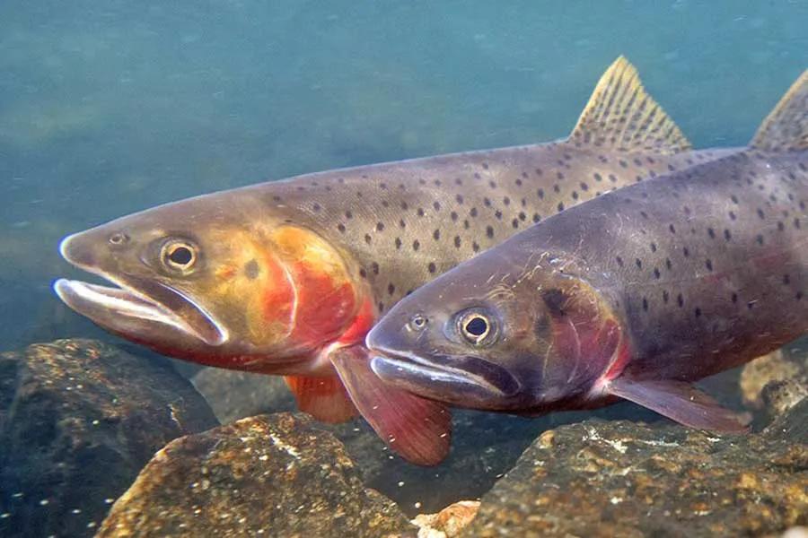
Fishing species: The drainage contains rainbow trout, brook trout, lake trout, arctic grayling and whitefish.
Belly River
The Belly River flows through a lush, narrow valley until it reaches the Ranger Station and Gable Creek Campground. The jagged, snowcapped pinnacles provide a panoramic sweep of the valley's promise as the trail winds in and out of spruce, lodgepole and quaking aspen. Grass and wildflowers sway kneehigh, providing abundant forage for elk, deer and other wildlife. Just above the Belly River Ranger Station, the river splits with one fork leading to Elizabeth Lake and the other fork leading to Cosley Lake. As it is glacierfed, this little river rips up the streambed during spring run-off. In spite of the abundant insect presence during the summer, the river's cold rushing waters do not provide the best habitat. Fishing is reported to be fair, although it is good in its diversity of species offerings.
When the river drops in late summer in time for hopper fishing, the meadow sections reportedly fish well. I must confess that I did not fish it. I was just too pooped to fish when I reached Gable Creek Campground. Every backcountry angler I queried said the same thing: a day hike down to the Belly River would provide incredible scenery, absolute solitude and fair to good fishing for rainbow trout, brook trout and arctic grayling. From the trailhead to the Belly River Ranger Station and campground is 6.1 miles and offers a number of campsites as well as a stock area. Into this garden of paradise, pesky flies and mosquitoes greet hikers. Be prepared. Bring plenty of repellant during early summer. I found that a mosquito net over my head was perfect for those short trail naps!
Cosley Lake, Glenns Lake and Mokowanis River
Traveling 6.1 miles to the Belly River Ranger Station and Gable Creek Campground, the trail splits. From the ranger station to Elizabeth Lake is 3.5 miles. From this point to Cosley Lake is two miles, plus another six-tenths to the campground, a total of 8.7 miles from the trailhead. Just behind the campground, the trail crosses the Belly River via a one-person suspension bridge. A ford is marked just below the bridge. The trail climbs up the slope, eventually following the Mokowanis River. Just before the trail crests, hikers are treated with a view of the Gros Ventre Falls plunging 100 feet into a cauldron of foam and a deep green pool.
Cosley Lake is beautiful, and campers are treated to their own beachfront campsites. Directly across the lake is the colorful and rugged Cosley Ridge. At the head of the lake towards Mokowanis Lake, Mount Merritt and Pyramid Peak provide huge patches of snow, along with cascading falls for picture-perfect photographs of Glacier grandeur.
Although Cosley Lake has a few trout, it is basically barren with the exception of some lake trout patrolling the bottom. The outlet of Cosley Lake and the Mokowanis River above the falls were equally disappointing. I talked to one Park biologist who was studying the lynx population, and he told me that all of the lakes connecting the Mokowanis River were either near barren or disappointing in fish counts and frequency of catches. The inlet to Cosley Lake provides the best fishing, but it has now been closed to protect nesting eagles.
Glenns Lake, just above Cosley Lake, is also rated poor fishing. Mokowanis Lake, the last lake in this string of lakes, offers fair to good fishing for small brook trout. So, what does a hiker who is eager to catch some high-elevation trout do? Simple solution! From the foot of Cosley Lake, hikers may cross the outlet at the cable crossing and hike 3.7 miles to Elizabeth Lake.

