The Rocky Mountain Front has always stood as a fortress or battlement to challenge travelers plying their way across the vast and sweeping prairies. Extending from the eastern flanks of Glacier National Park to the Missouri River in the Helena area, this towering mountain range encompasses one of the most awesome wilderness areas in Montana. With more than 1.5 million acres of towering peaks, nestled lakes and pristine streams, travelers by foot or horseback may weave their way across the Continental Divide in Glacier National Park, the Great Bear Wilderness, the Bob Marshall Wilderness and the Scapegoat Wilderness.
It is easy to imagine native Americans following the bison across this vast grassland at the entrance to the Rocky Mountain Front. With a sparse population of 2.8 people per square mile, and cattle outnumbering people 10 to one, the area still retains its heritage as both cattle country and farm country, most notably in barley and wheat. Three rivers flow out of the Front.
The first of these is the Dearborn River, which is closest to Highway 200 (the main artery which connects Missoula and Great Falls). The Upper Dearborn River is restricted to trail access only. The trailhead is just that - a trailhead. The small parking area restricts camping. The Lower Dearborn River meanders through private ranchland and may only be floated in good water years.
General location: Highway 200 north of Lincoln and south of Augusta on the Rocky Mountain Front.
Directions: From Missoula take Highway 200 north past the town of Lincoln and over Rogers Pass. After crossing the Middle Fork of the Dearborn, watch for a highway crossing. To the right (south) will be a paved road 19 miles to Wolf Creek and the Missouri River. Turn left (north) on county road #434, a graded dirt road, 11.4 miles to the intersection to Bean Lake. At 11.4 miles turn left and go seven-tenths of a mile to Bean Lake. Continue on Dearborn River Road #577 past Bean Lake to the canyon trailhead, a distance of 5.1 miles. Bean Lake is a small, popular pothole lake and good fishing for stocked rainbows in the early summer.
Trailhead: Located on BLM land, the trailhead prohibits overnight camping and offers only an outhouse and a hitching rail. The trail to the canyon and National For-est land passes through private property, so please stay off the private road and on the designated trail. At the trailhead the USFS sign states that it is 1.8 miles to National Forest land. However, at three-quarters of a mile from the trailhead, the trail crosses the Dearborn River on a newly constructed bridge. The property owner's sign next to the bridge claims three miles of private property after the bridge crossing. Regardless of which sign is accurate, the first campsite is approximately four miles from the trailhead.
Backcountry Camping: One of the gateways to the Scapegoat Wilderness, the Dearborn River plunges over granite rock out of the Rocky Mountain Front. The mountains command your attention. Steep and rugged, the river-carved granite presents a stark contrast to the rolling prairie grasslands and pocket lakes just a few miles away. Crossing the bridge by the last summer cabin a little less than a mile from the trailhead, the trail winds its way up the northern side of the river to the first spectacular view of the canyon. The timeless art of water-carved rock inspires a moment of reflection before pushing up the trail. From the trailhead to the bridge is a 25-minute hike. From the bridge to the first campsite is about a 45-minute hike. About five minutes up the trail from the first campsite, the trail forks down to the river past a second nice campsite. Just past this campsite on this spur trail, the trail crosses the river to a large flat area, which can accommodate a number of campers. Another mile or two above this fork, the trail climbs up a steep-walled canyon past Devils Glen, a carved canyon of granite at the base of Steamboat Mountain. After you cross a steep slide of shale, the trail follows close to the river again and offers a number of shaded campsites in a narrow part of the canyon. The trail offers an easy to moderate hike for all ages.
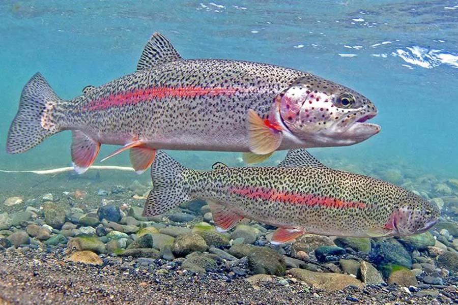
Although this creek-sized river appears to be a sterile environment of rock pools and slides in gin-clear water, the fish are fairly abundant. However, do not come looking for the more common riffle-pool run. Instead, plan on fishing pools and pockets with very short riffles in between. The pools, with vertical rock cliffs on both sides can be quite restrictive. Scrambling around the ledges, hide behind rock outcroppings and make your first cast be your best shot. If your cast is delicate, you may raise a small 10- to 12-inch rainbow fanning just under the surface in the shadows of sheer rock ledges. If you are lucky, you may bring up one of the big boys hugging the bottom of the pool, 10 to 15 feet below your fly. The best time to fish this giant rock garden is late August through September, when detours up and around these mini canyons are minimized and the hoppers are crackling everywhere. I found the fishing to be both challenging and novel. After fishing for about three hours, I never succeeded in bringing up one of the big rainbows from the bottom, but I did talk to a fly fisherman who had landed an 18-inch rainbow on a hopper towards evening.
River description by David Archer

