The Kootenai River / Highway 2
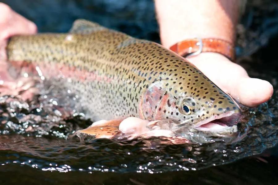
The Kootenai River, from Libby Dam 17 miles downriver to Libby, is another great tail-water fishery for Montana. After years of pressure from anglers, biologists and local concerned citizens, the days of wild water fluctuations have come to an end. Posing danger to fishers and floaters, the erratic rise and fall of the river also posed a threat to the insect larva stranded high and dry by the whims of the Army Corps of Engineers. With current standards for water drawdown, insect larva have a chance to retreat into deeper receding water. With consistent yearly insect survival, the Kootenai River gets better every year, and the fish are fat and aggressive. Fish biologists estimate that the river holds in excess of 2,000 fish per mile.
The cold waters of March and April provide fishing opportunities for rainbows during the spawning period. Although the water can be off-colored from tributaries below the dam such as the Fisher River and Libby Creek, anglers can experience some good nymphing and streamer fishing. During May and June the water begins to warm, precipitating the emergence of caddis and the Western March Brown. Dry fly fishing heats up, and by far the most important hatch is the PMDs ranging in size 14 to 16 in the early summer to size 18 in the latter part of summer. Typically the spinnerfall occurs in the morning with the duns coming off in late afternoon. Be sure you have patterns on hand for the emergers, as well as the duns. July and August may bring the heat to the fishermen, but the warmer water activates fish feeding on both dry flies and hoppers. Keep in mind that when other Montana rivers heat up late summer, the Kootenai River runs cool, as a tail-water river. The fall brings foliage change and clarity to the river. With lots of mid-day hatches, trout are eager to store up fat reserves for the winter. Blue-wing olives work well even into the latter part of November. Although streamers are used for targeting Bull trout, for the most part the river is a classic dry fly river.
Wade fishing is best from 8,000 cubic feet per second to 12,000 cfs. It is next to impossible during high water releases of over 15,000 cfs. When the water rises, guides and float fishermen move to the side channels for the larger trout. Popular float trips originate at the dam with the final take-out in the town of Libby. The 17-mile section can be broken up into a number of potential float trips, depending how much time one would like to spend on the water. Below Libby are the deadly Kootenai Falls.
Powerboat operators fishing below the Libby Bridge should first confer with a local expert. Although the world record rainbow at 33 pounds, one ounce, was caught at the outlet of the dam, the average catch of the day will be around 10 to 14-inches with plenty of 18+-inch trout to challenge any angler.
Overlooked for years by the fly-fishing public who ply the waters of the Madison and Missouri, people in the know are looking to the northwest. A tour of the Clark Fork drainage rivers and then a sampling of the Kootenai provides excellent trout fishing.
River Description by David Archer
Access
Tributaries
Access
Access to the Kootenai River (from Highway 2 below Troy to Libby)
Note: MM=Mileage Marker signs
MM 1.9: Fishing access to the Kootenai River
The access is right next to a residence. Drive one mile to a parking place, but do not drive the last two-tenths of a mile to the old bridge - it is steep at the bottom, and there is little room to turn around. The road is bumpy and un-maintained and leads to a closed bridge. Upriver from the bridge is a long bank with shallow water. Park up from the bridge and follow the trail down to the river. This could be a good evening spot in the early summer or fall.
MM 3: Junction with Route 508 to Yaak, Montana. Two dueling bars face each other across the street.
MM 6.2: Yaak Campground, Boat Launch. 44 campsites, pull-throughs, water, toilets, fee area.
MM 7.8: Fishing access. The turn-around offers a jeep trail which follows the river downstream.
MM 10: Fishing access, boat launch. Follow Forest Drive and then Beachward Trail a half-mile to a nice boat launch.
MM 10: Kilbrennan Lake: 9.2 mile. Kilbrennan Lake is a 59-acre lake, and is deep in the middle. At the far end of the lake is a non-fee campground and a boat launch. The lake is full of perch and bullhead, but boat fishermen can catch good numbers of brook trout on the side of the lake opposite the road. Locals tend to fill up this campground Thursday through Sunday. Seven campsites, toilets, non-fee.
MM 11.8: Bridge crossing.
MM 14: Troy, Montana; Kootenai River boat launch. Turn on Third Street and drive four-tenths of a mile, and then turn left on Riverside Drive another four-tenths of a mile to the launch.
MM 15: Callahan Creek Road. Callahan Creek is not accessible in its lower reaches near Troy, as the road climbs up the mountain for a number of miles. To fish this creek, you will need to drive all the way back to the bridge by the south fork and north fork. From this point you can fish the main stem of the creek or the forks. The creek is boulder-strewn, however, so walking is tough for the young and old. Fish for small cutthroats. The road is paved all the way with the exception of the last mile and a half. From the highway to the bridge is 7.5 miles.
MM 21: Kootenai Falls Scenic Trail
MM 22.2: Fishing access along the railroad track.
MM 23: Fishing access (rapids).
MM 30: Libby, Montana.
Tributary Creeks and Lakes of the Kootenai River
Side Trip - Route 567 from Libby to Yaak. (Alternate route.) Follow California Street out of Libby and cross the Kootenai River (boat launch just by the bridge). California Street changes to Route 567. Take Route 567 (also called Pipe Creek Road) to Yaak, a distance of 37 miles. Pipe Creek gets fairly small during the summer. Nonetheless, it offers good fishing for small trout. The East Fork of Pipe Creek is a tiny, brushy creek holding small brookies.
Tributaries
Side Trip to the Fisher River, Shortcut to Highway 2 connecting Kalispell and Libby
The Fisher River access is at mileage marker 14 on Highway 37 a few miles below the Libby Dam. The Fisher River is only fair fishing for small rainbows and whitefish. The road is paved and runs 24 miles to meet Highway 2. The road is narrow in places. Primitive campsites may be found throughout the Fisher River drainage.
Side Trip - Route 567 from Libby to Yaak. (Alternate route.) Follow California Street out of Libby and cross the Kootenai River (boat launch just by the bridge). California Street changes to Route 567. Take Route 567 (also called Pipe Creek Road) to Yaak, a distance of 37 miles. Pipe Creek gets fairly small during the summer. Nonetheless, it offers good fishing for small trout. The East Fork of Pipe Creek is a tiny, brushy creek holding small brookies.
Side Trip to the Fisher River, Shortcut to Highway 2 connecting Kalispell and Libby
The Fisher River access is at mileage marker 14 on Highway 37 a few miles below the Libby Dam. The Fisher River is only fair fishing for small rainbows and whitefish. The road is paved and runs 24 miles to meet Highway 2. The road is narrow in places. Primitive campsites may be found throughout the Fisher River drainage.
Lake Koocanusa
Straddling the border with 48 miles in Montana and 42 miles in British Columbia, Lake Koocanusa was formed with the creation of the Libby Dam in 1971. Alice Beers of Rexford, Montana, coined the name for the lake. The name combines the first part of Kootenai, the second part "can" from Canada and the last three letters for "USA". The lake is immense and offers very marginal shore fishing. The principal draw is the prodigious numbers of kokanee salmon ranging from 11 to 14-inches. Large kamloop rainbows lure boat fishers from all around the region. Boaters will find plenty of water to fish with over 46,000 surface acres. Campground and boat launches are spread evenly around the lake.
Highway 37 from Libby to Eureka, via Lake Koocanusa
Highway 37 passes the Libby Dam via Lake Koocanusa, 66 miles to Eureka and then into Canada on Highway 93 to Banff and Jasper National Parks in British Columbia. Parallel to this highway is a paved road on the other side of the lake that intersects with the highway at the Koocanusa Bridge, a distance of 45 miles. Take California Street to the bridge crossing and the city boat launch.

